27th December
Not the walk we’d planned…but then we’re learning that, round here, because it’s marked on the map doesn’t mean it exists! Our original walk (see Google Map magenta below, compared to planned walk, cyan) was thwarted at Higher Kenneggy Farm. The footpath would have taken us across the fields to Lower Kenneggy but prominent signs in the hedge strongly discourage further progress. We suspect this is because the owners of the Kenneggy Cove Holiday Park don’t want the unwashed walking through their shiny caravan park. Instead we head down to the coastal footpath at Kenneggy Sands and walk along the cliffs to Sydney Cove & Praa Sands, where we stop off at the Sandbar while we plot what to do next.
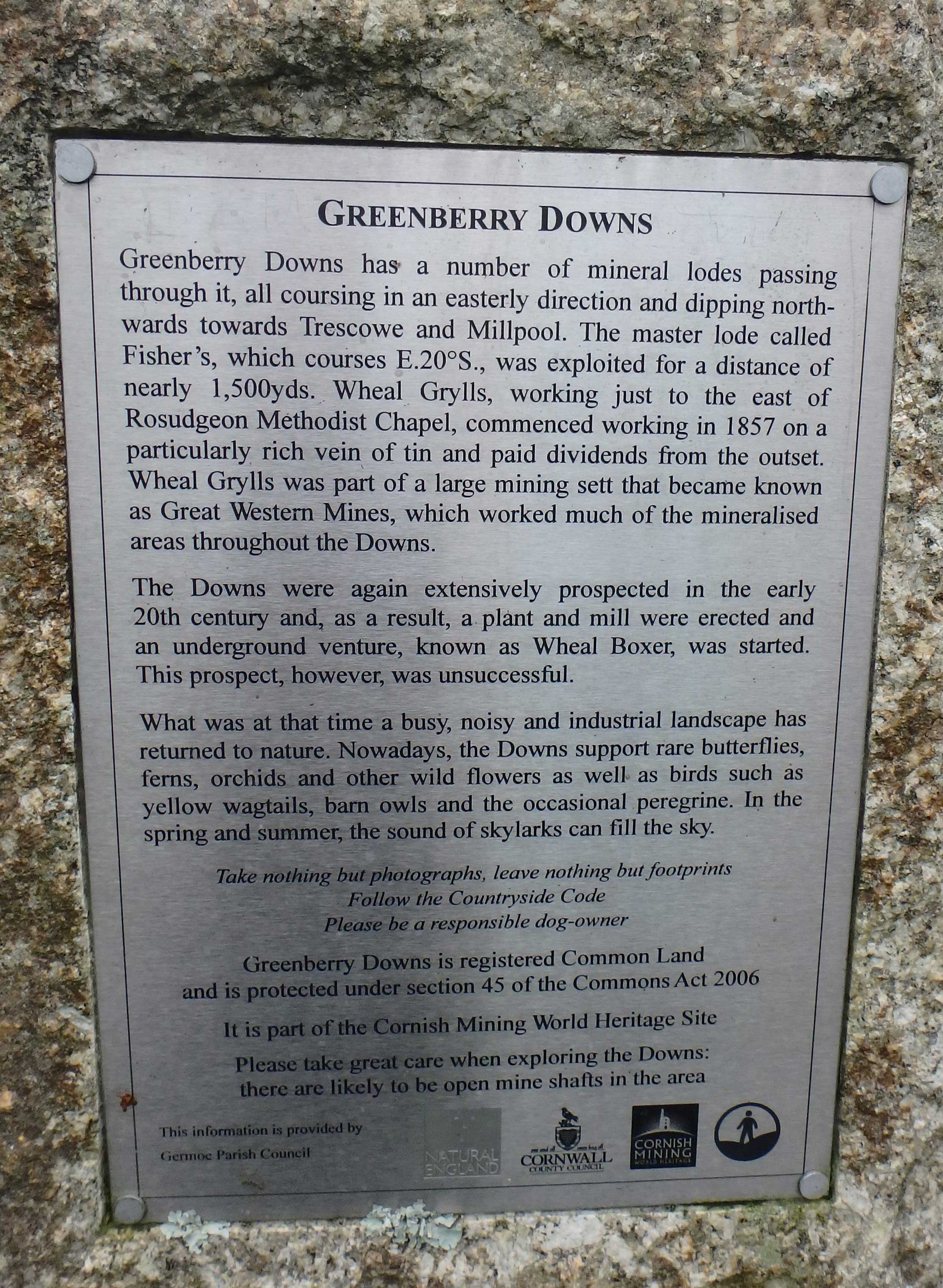
Rather than re-trace our tracks we climb out of Sydney Cove along Penreath Lane as far as Newtown and return to Perran Downs by way of the back lanes and Greenberry Downs and Woodstock. Much Poldark-type mining here 200 years ago (and as recently as the early 20th Century) but no evidence now. No doubt, the engineers in the family can fill in the details…
A leisurely 5.8 mile walk on a balmy Winter’s morning-just what was needed after Christmas excesses.
Coordinates for Satnav: N50° 07.380′ W5° 25.456′
Distance: 5.8 miles; Difficulty: Easy
![]()
![]()
![]()
Praa Sands picture gallery-


